



Page 14
Page 14

Geospatial Vision : New Dimensions in Cartography
This book reflects the diverse nature of interests of contributors in the field. The GeoCart conferences are held every two years and attract attendees from Australasia and globally. They offer a forum for reflecting on past practices, exploring future possibilities and reporting on the findings of - search undertakings. They make valuable contributions to the theory and praxis of Geoinformation and Cartography.

Geo-Spatial Technologies in Urban Environments : Policy, Practice, and Pixels
This book expands the current frame of reference of remote sensing and geographic information specialists to include an array of socio-economic and related planning issues.

Geo-spatial technologies in urban environments : Policy, practice, and pixels
The purpose of this book is to investigate and develop alternate methodological approaches to understand urban environments and urban change. In particular, the study demonstrates the application of remote-sensing data and geographic information systems to the exploration of issues often ignored by the mainstream community of geo-technical specialists such as urban forestry, urban traffic, migration or quality of life in urban areas. Case studies show how disciplines like environmental science and planning, sociology, landscape ecology and architecture, regional science and policy design, and assessment can benefit from employing remote-sensing data and GIS.

Geospatial Technologies and Homeland Security : Research Frontiers and Future Challenges
This book presents an overview of the latest development of geospatial technologies (including, but not limited to, GIS, RS, GPS, LBS, spatial analysis and modelling etc.) and their applications in piecing together the complex puzzles facing the challenges of the homeland security research and education. A wide variety of topics, ranging from conceptual and methodological to technical and social/legal issues

Geospatial Services and Applications for the Internet
This book covers a wide spectrum of techniques, algorithms and modeling methodologies that address the challenges in service-oriented architectural design for GIS, and intelligent processing for spatial queries. This book presents in-depth studies on performance improvement, data integration, service personalization and interoperation between geospatial services. These studies provide the reader with a wide spectrum of examples and case studies on the development of GIS for hydrological applications, electrical power supply applications, land usage and urban planning, and NASA’s Earth image datasets dissemination.

GeoSpatial semantics ; 2nd International Conference, GeoS 2007, Mexico City, Mexico, November 29-30, 2007
This paper reports a simple case study of extracting the two types of such hierarchies from formal texts of traffic code. Problems of concurrent use of both hierarchies for ontology reasoning are dis-cussed, particularly, in context of the different views on geospatial ontologies.
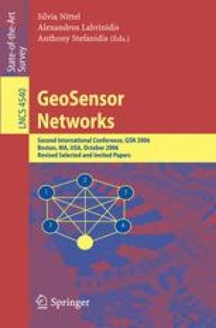
GeoSensor Networks : 2nd International Conference, GSN 2006, Boston, MA, USA, October 1-3, 2006, Revised Selected and Invited Papers
This book constitutes the thoroughly refereed proceedings of the Second GeoSensor Networks Conference, held in Boston, Massachusetts, USA, in October 2006. The conference addressed issues related to the collection, management, processing, analysis, and delivery of real-time geospatial data using distributed geosensor networks. This represents an evolution of the traditional static and centralized geocomputational paradigm.

Geological atlas of Africa : With notes on stratigraphy, tectonics, economic geology, geohazards, geosites and geoscientific education of each country
T is atlas is intended primarily for anybody who is in-some background for the arrangement of how the terested in basic geology of Africa. Its originality lies atlas was done. T e second chapter is devoted to the in the fact that the regional geology of each African history of geological mapping in Africa, necessary nation or territory is reviewed country-wise by maps for a fuller appreciation of why this work in Africa is and text, a view normally not presented in textbooks worth doing. Chapter 3 provides an executive s- of regional geology. It is my belief, that there has long mary on the stratigraphy and tectonics of Africa as a been a need in universities and geological surveys, whole, i. e. in the context of no political boundaries.

Geo-information for Disaster Management
Geo-information technology offers an opportunity to support disaster management: industrial accidents, road collisions, complex emergencies, earthquakes, fires, floods and similar catastrophes (for example the recent huge disaster with the Tsunami in South-East Asia on 26 December 2004). Access to needed information, facilitation of the interoperability of emergency services, and provision of high-quality care to the public are a number of the key requirements. The book provides a broad overview of the (geo-information) technology, software, systems needed, used and to be developed for disaster management. The book provokes a wide discussion on systems and requirements for use of geo-information under time and stress constraints and unfamiliar situations, environments and circumstances.
Geographic Information Science ; 5th International Conference, GIScience 2008, Park City, UT, USA, September 23-26, 2008. Proceedings
This book constitutes the refereed proceedings of the 5th International Conference on Geographic Information Secience, GIScience 2008, held in Park City, UT, USA, in September 2008.The 24 revised full papers presented were carefully reviewed and selected from 77 submissions. Among the traditional topics addressed are spatial relations, geographic dynamics, and spatial data types. A significant number of papers deal with navigation networks, location-based services, and spatial information query and retrieval. Geo-sensors, mobile computing, and Web mapping rank among the important new directions.

Geographic Information Science ; 4th International Conference, GIScience 2006, Münster, Germany, September 20-23, 2006, Proceedings
The GIScience conference series (www. giscience. org) was created as a forum for all researchers who are interested in advancing research in the fundam- tal aspects of geographic information science.The conferences focus on emerging topics and basic research ?ndings across all s- tors of geographic information science. After three highly successful conferences in the United States, this year’s GIScience conference was held in Europe for the ?rst time. The GIScience conferences have been a meeting point for researchers coming from various disciplines, including cognitive science, computer science, engine- ing, geography,information science, mathematics, philosophy, psychology,social science, and statistics. The advancement of geographic information science - quiressuchinterdisciplinarybreadth,andthisisalsowhatmakestheconferences so exciting. In order to account for the di?erent needs of the involved scienti?c disciplines with regard to publishing their research results.
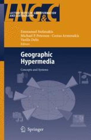
Geographic Hypermedia : Concepts and Systems
This book introduces a new paradigm, Geographic Hypermedia, which emerges from the convergence of Geographic Information Science and - permedia technology. Both GI Science and hypermedia have been rapidly evolving fields. The initial idea of Geographic Hypermedia was born in 2004 when the editors had been invited to organize a workshop in conju- tion with the ‘Hypertext’ conference organized annually by the Special - terest Group of the Association for Computing Machinery. The purpose of the workshop was to examine how hypermedia concepts and tools may be applied in geographical domains. The workshop was eventually held in conjunction with the Maps and the Internet Commission of the International Cartographic Association at the annual meeting of the Association of American Geographers in Denver, Colorado, in April 2005. The Denver workshop was a successful event, bringing together mul- disciplinary researchers and professionals in the area of Geographic - permedia.

Geodetic and geophysical observations in Antarctica : An overview in the IPY perspective
This book is a collection of papers on various aspects of the scientific investigation and observation techniques of the polar regions at both temporary and permanent observatories. Most papers focus on regional models based on data acquired in polar regions. Geodetic satellite positions systems (GNSS: GPS, GLONASS, GALILEO) will also be discussed as well as other space techniques (DORIS, VLBI). Gravimetry, absolute gravimetry, and tidal gravimetry are also discussed, as well as seismology and meteorology.

Genetic Systems Programming : Theory and Experiences
This book is devoted to reporting innovative and significant progress about the contribution of genetic programming in systems programming. The contributions of this book clearly demonstrate that genetic programming is very effective in solving hard and yet-open problems in systems programming. Followed by an introductory chapter, in the remaining contributed chapters, the reader can easily learn about systems where genetic programming can be applied successfully. These include but are not limited to, information security systems, compilers, data mining systems, stock market prediction systems, robots and automatic programming.

Gender Designs IT : Construction and Deconstruction of Information Society Technology
The book not only offers a gender analysis of information society technologies, it also shows practical examples of how IT can be different. A gender perspective on IT design can serve as an eye-opener for what tends to be overlooked and left out. It yields innovative ideas and high quality software systems that may empower a large diversity of users for an active participation in our information society.

Fuzzy Modeling with Spatial Information for Geographic Problems
This book focuses on research advances in approaches for incorporating explicit handling of uncertainty, especially by fuzzy sets, to address geographic problems. It has two aims: to stimulate research in the theory and application of fuzzy sets to spatial information management and geographic problem solving; and to highlight advances that have matured so much that geoscientists, computer scientists, geographers, et al. use fuzzy modeling. The book includes examples of the use of fuzzy sets in representational issues such as terrain features, landscape morphology, spatial extents and approaches for spatial interpolation, plus applications using fuzzy sets covering data mining, spatial decision making, ecological simulation, and reliability in GIS.

Fuzzy database modeling with XML
Fuzzy Database Modeling with XML aims to provide a single record of current research and practical applications in the fuzzy databases. This volume is the outgrowth of research the author has conducted in recent years. Fuzzy Database Modeling with XML introduces state of the art information to the database research, while at the same time serving the information technology professional faced with a non-traditional application that defeats conventional approaches. The research on fuzzy conceptual models and fuzzy object-oriented databases is receiving increasing attention, in addition to fuzzy relational database models. With rapid advances in network and internet techniques as well, the databases have been applied under the environment of distributed information systems. It is essential in this case to integrate multiple fuzzy database systems. Since databases are commonly employed to store and manipulate XML data, additional requirements are necessary to model fuzzy information with XML. Second, this book maps fuzzy XML model to the fuzzy databases. Very few efforts at investigating these issues have thus far occurred.

Future Interaction Design
In 1969 Herbert Simon wrote a book, The Science of the Artificial, in which he argued that cognitive science should have its area of application in the design of devices. He proposed the foundation of a science of the artificial related with cognitive science in the sense in which we have traditionally understood the relationship between the engineering disciplines and the basic sciences. Such a science has been called cognitive ergonomics or cognitive engineering (Norman 1986). Simon’s cognitive ergonomics (1969), would be independent of cognitive science, its basic science, although both would be closely related. Cognitive science would contribute knowledge on human cognitive processes, and cognitive ergonomics would contribute concrete problems of design that should be solved in the context of the creation of devices. Norman (1986), the author that coined the term cognitive engineering, conceived it as an applied cognitive science where the knowledge of cognitive science is combined with that of engineering to solve design problems. According to Norman, its objectives would be: (1) to understand the fundamental principles of human actions important for the development of the engineering of design principles, and (2) to build systems that are pleasant in their use.

Fundamentals of multimedia ; 3rd ed.
Addresses real issues commonly faced in the workplace. The essential concepts are explained in a practical way to enable students to apply their existing skills to address problems in multimedia. Fully revised and updated, this new edition now includes coverage of such topics as 3D TV, social networks, high-efficiency video compression and conferencing, wireless and mobile networks, and their attendant technologies.
Fundamentals of multimedia ; 2nd ed.
Addresses real issues commonly faced in the workplace. The essential concepts are explained in a practical way to enable students to apply their existing skills to address problems in multimedia. Fully revised and updated, this new edition now includes coverage of such topics as 3D TV, social networks, high-efficiency video compression and conferencing, wireless and mobile networks, and their attendant technologies.
