



الصفحة 1
الصفحة 1

Observing our Changing Earth ; Proceedings of the 2007 IAG General Assembly, Perugia, Italy, July 2 - 13, 2007
Contains a selection of 99 papers from the International Association of Geodesy (IAG) quadrennial General Assembly, held in Perugia, Italy, from July 2 to 13, 2007, in conjunction with the XXIV General Assembly of the International Union of Geodesy and Geophysics (IUGG).

Observation of the Earth System from Space
A special highlight is the - termination of seasonal gravity variations caused by changes in continental water masses. For GOCE, to be launched in 2006, new gravity field analysis methods are under development and integrated into the ESA processing s- tem. 200,000 GPS radio occultation pro?les, observed by CHAMP, have been processed on an operational basis. They represent new and excellent inf- mation on atmospheric refractivity, temperature and water vapor. These new developments require geodetic space techniques (such as VLBI, SLR, LLR, GPS) to be combined and synchronized as if being one global instrument.

Object-Based Image Analysis : Spatial Concepts for Knowledge-Driven Remote Sensing Applications
This book discusses means, technologies and approaches related to the processing and analysis of multi-sensor, multi-resolution data with a focus on the generation, modelling and classification of objects. The applications also address the integration of Geographic Information and the concurrent developments of GIScience and vanquish limitations of pixelwise image processing by exploiting image information context-driven and "intelligently".

Nonlinear Time Series Analysis in the Geosciences : Applications in Climatology, Geodynamics and Solar-Terrestrial Physics
This book presents recent developments in nonlinear time series which have been motivated by present day problems in geosciences. Modern methods of spatio-temporal data analysis, time-frequency analysis, dimension analysis, nonlinear correlation and synchronization analysis and other nonlinear concepts are used to study emerging questions in climatology, geophysics, solar-terrestrial physics and related scientific disciplines. This volume collects contributions of some of the world's leading experts in geoscientific time series analysis.

Modeling Solar Radiation at the Earth’s Surface : Recent Advances
Solar radiation data is important for a wide range of applications, e.g. in engineering, agriculture, health sector, and in many fields of the natural sciences. A few examples showing the diversity of applications may include: architecture and building design e.g. air conditioning and cooling systems; solar heating system design and use; solar power generation; weather and climate prediction models; evaporation and irrigation; calculation of water requirements for crops; monitoring plant growth and disease control; skin cancer research.

Microearthquake Seismology and Seismotectonics of South Asia
This volume comprehensively deals with plate tectonics and seismic waves in general and earthquake monitoring by permanent and temporary networks for active fault mapping, aftershock, swarm and induced seismicity investigations in interplate collision and subduction zones and in intraplate shield region.
Methods of Celestial Mechanics ; Vol. II : Application to Planetary System, Geodynamics and Satellite Geodesy
G. Beutler's Methods of Celestial Mechanics is a coherent textbook for students as well as an excellent reference for practitioners. Volume II is devoted to the applications and to the presentation of the program system CelestialMechanics. Three major areas of applications are covered: (1) Orbital and rotational motion of extended celestial bodies. The properties of the Earth-Moon system are developed from the simplest case (rigid bodies) to more general cases, including the rotation of an elastic Earth, the rotation of an Earth partly covered by oceans and surrounded by an atmosphere, and the rotation of an Earth composed of a liquid core and a rigid shell (Poincaré model). (2) Artificial Earth Satellites. The oblateness perturbation acting on a satellite and the exploitation of its properties in practice is discussed using simulation methods (CelestialMechanics) and (simplified) first order perturbation methods. The perturbations due to the higher-order terms of the Earth's gravitational potential and resonant perturbations are considered thereafter. Special attention is paid to satellites of the Global Navigation Satellite Systems and to geostationary satellites. The characteristics of and models for the two most important non-gravitational forces, atmospheric drag and radiation pressure, are presented as well as the most relevant forces acting on high- and low-orbiting satellites. (3) Evolution of the Planetary System. The outer planetary system consisting of the planets Jupiter to Pluto is studied over long time intervals using simulation methods and spectral analysis (CelestialMechanics). The properties of the inner systems, in particular of the Earth's orbit, are made visible by integrating the entire system over long time intervals relevant for climate change. The distribution of minor planets and their orbital properties, regular orbits, and chaotic orbits are easily generated and analyzed using CelestialMechanics. The volume concludes with the discussion of important mathematical tools of the program system and of the principles of spectral analysis.

Historical Seismology : Interdisciplinary Studies of Past and Recent Earthquakes
Modern seismology has faced new challenges in the study of earthquakes and their physical characteristics. This volume is dedicated to the use of new approaches and presents a state of the art in historical seismology. Selected historical and recent earthquakes are chosen to document and constrain related seismic parameters using updated methodologies in the macroseismic analysis, field observations of damage distribution and tectonic effects, and modelling of seismic waveforms. A critical re-evaluation of historical accounts and early seismograms provides us with the basis for a realistic seismic hazard assessment.

Gravity, Geoid and Space Missions ; GGSM 2004. IAG International Symposium. Porto, Portugal. August 30 - September 3, 2004
GGSM2004 aimed to bring together scientists from different areas in the geosciences, working with gravity and geoid related problems, both from the theoretical and practical points of view. Topics of interest included the integration of heterogeneous data and contributions from satellite and airborne techniques to the study of the spatial and temporal variations of the gravity field. In addition to the special focus on the CHAMP, GRACE, and GOCE satellite missions, attention was also directed toward projects addressing topographic and ice field mapping using SAR, LIDAR, and laser altimetry, as well as missions and studies related to planetary geodesy.

GPS : Theory, algorithms and applications
This reference and handbook describes Global Positioning System (GPS) theory, algorithms and applications. It is primarily based upon source-code descriptions of the KSGSoft program developed by author at the GFZ in Potsdam. The theory and algorithms are revised and extended for a new development of a multiple functional GPS software. New concepts such as the unified GPS data processing method and ambiguity-ionospheric algorithm, as well as general ambiguity search criteria, are reported for the first time. Mathematically rigorous, the book begins with the basics of coordinate and time systems and satellite orbits, as well as GPS observables, and deals with topics such as physical influences, observation equations, adjustment and filtering, ambiguity resolution, data processing, kinematic positioning, and the determination of perturbed orbits.

Geotechnical Engineering for Disaster Mitigation and Rehabilitation ; Proceedings of the 2nd International Conference GEDMAR08, Nanjing, China 30 May – 2 June, 2008
"Geotechnical Engineering for Disaster Mitigation and Rehabilitation" presents the latest developments and case studies in the field. All contributions to this proceedings were rigorously reviewed to cover the newest developments in disasters related to earthquakes, landslides and slopes, soil dynamics, risk assessment and management, disaster mitigation and rehabilitation, and others.
Geometrical Geodesy : Using Information and Computer Technology
This book reviews developments in geodesy and hydrography, using a wide variety of electronic and acoustic instruments. The aim is to take stock of the latest fundamental geodetic constants for the 2000s, to focus on dissimilar ellipsoidal areas, distances, and conversion of applications, referenced to an abundant bibliography. It presents a mixture of issues, dealing with reference and time systems, datums, and s-transformations, elucidate multi-dimensional aspects of the information, communication, and computation technology, including the use of parallel computers. Stressing the hands-on methodology, the handbook is of interest to geodetic engineers, consultants, hydrographers, and engineers with an interest in the field of earth sciences.
Geological atlas of Africa : With notes on stratigraphy, tectonics, economic geology, geohazards, geosites and geoscientific education of each country
T is atlas is intended primarily for anybody who is in-some background for the arrangement of how the terested in basic geology of Africa. Its originality lies atlas was done. T e second chapter is devoted to the in the fact that the regional geology of each African history of geological mapping in Africa, necessary nation or territory is reviewed country-wise by maps for a fuller appreciation of why this work in Africa is and text, a view normally not presented in textbooks worth doing. Chapter 3 provides an executive s- of regional geology. It is my belief, that there has long mary on the stratigraphy and tectonics of Africa as a been a need in universities and geological surveys, whole, i. e. in the context of no political boundaries.
Geodetic Deformation Monitoring : From Geophysical to Engineering Roles ; IAG Symposium Jaén, Spain, March 7-19,2005
Geodesy is the science dealing with the determination of the position of points in space, the shape and gravity field of the Earth and with their time variations. A consequence is that geodesists feel as a permanent subject of research, the detection, analysis and interpretation of spatial deformation as well as gravity field variation. This book collects 36 selected papers from the International Symposium on Geodetic Deformation Monitoring held in Jaén (Spain) from 17th to 19th March 2005. The main topics covered in the symposium were: mathematical and statistical models for crustal deformation analysis, deformation monitoring from GPS and InSAR data: analysis and geophysical interpretation, geodetic monitoring of movements in civil engineering, integration of spatial and terrestrial techniques in deformation studies, geodynamical applications of gravimetric observations and present-day geodetic instrumentation for deformation monitoring. This volume is a good overview of theoretical matters, models and results.

Geodetic and geophysical observations in Antarctica : An overview in the IPY perspective
This book is a collection of papers on various aspects of the scientific investigation and observation techniques of the polar regions at both temporary and permanent observatories. Most papers focus on regional models based on data acquired in polar regions. Geodetic satellite positions systems (GNSS: GPS, GLONASS, GALILEO) will also be discussed as well as other space techniques (DORIS, VLBI). Gravimetry, absolute gravimetry, and tidal gravimetry are also discussed, as well as seismology and meteorology.

Future Satellite Gravimetry and Earth Dynamics
Currently, a first generation of dedicated satellite missions for the precise mapping of the Earth’s gravity field is in orbit (CHAMP, GRACE, and soon GOCE). The gravity data from these satellite missions provide us with very new information on the dynamics of planet Earth. In particular, on the mass distribution in the Earth’s interior, the entire water cycle (ocean circulation, ice mass balance, continental water masses, and atmosphere), and on changes in the mass distribution. The results are fascinating, but still rough with respect to spatial and temporal resolution. Technical progress in satellite-to-satellite tracking and in gravity gradiometry will allow more detailed results in the future. In this special issue, Earth scientists develop visions of future applications based on follow-on high-precision satellite gravimetry missions.
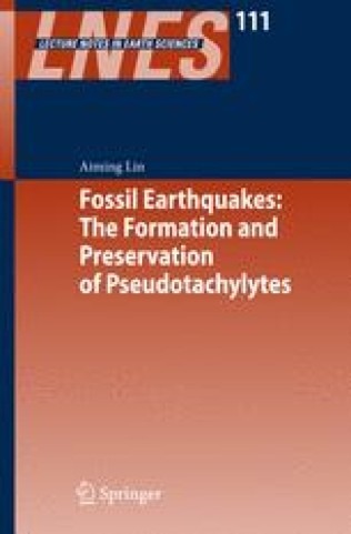
Fossil earthquakes : The formation and preservation of pseudotachylytes
This book encompass the principl results of field investigations, analyses of meso-scale and micro-scale textures and structures, laboratory experiments, chemical analyses, conceptual fault models, as well as the implications of fault related pseudotachylyte an its related fault rocks for our understanding of earthquakes. We hope that this book helps to bridge the gap between seismology and geology and that it encourages further studies of earthquake and seismic faulting processes.

Earthquakes : Simulations, Sources and Tsunamis
This book includes a variety of studies that focus on the modeling of tsunamis and earthquakes, both large-scale simulation and visualization programs, as well as detailed models of small-scale features. Particular attention is paid to computational techniques, languages, and hardware that can be used to facilitate data analysis, visualization, and modeling. Also included are studies of several earthquake forecasting techniques and associated comparisons of their results with historic earthquake data. Finally, the volume ends with theoretical analyses of statistical properties of seismicity by internationally recognized experts in the field. This volume will be of particular interest to researchers interested in the multiscale simulation and visualization of large earthquakes and tsunamis.

Earthquake Monitoring and Seismic Hazard Mitigation in Balkan Countries
this book including deployment of modern seismograph stations and arrays and these developments are detailed in the book. Station and network operations require near real time record analysis and topics dealt with here are 2-D signal detector, epicenter location and earthquake monitoring. Balkan is seismically the most active part of Europe due to multiple plate interactions in the Aegean Sea. The tectonic evolution and on-going geodynamic deformations are described in 2 articles. Earthquake hazard analysis and topographic site effects are discussed and likewise large earthquake hazards in the Aegean and the Marmara seas relate to practical applications of such procedures. Foremost; the book gives a good account of past, present and likely future seismological developments in Balkan countries and various kinds of network operations on local to global scales.

Earth Observation with CHAMP : Results from Three Years in Orbit
In the summer of 2000 the German geo-research satellite CHAMP was launched into orbit. Its innovative payload arrangement and the low initial orbit allow CHAMP to simultaneously collect and almost continuously analyse precise data relating to gravity and magnetic fields at low altitude. In addition, CHAMP also measures the neutral atmosphere and ionosphere using GPS techniques. Three years after launch, more than 200 CHAMP investigators and co-investigators from all over the world met at the GeoForschungsZentrum in Potsdam to present and discuss the results derived from the extensive data sets of the mission. The main outcome of this expert meeting is summarized in this volume. The book offers a comprehensive insight into the present status of the exploitation of CHAMP data for Earth system research and practical applications in geodesy, geophysics and meteorology.
