تحسين النتائح
ترتيب حسب
من
الى

Applied Spatial Data Analysis with R is divided into two basic parts, the first presenting R packages, functions, classes and methods for handling spatial data, The second part showcases more specialised kinds of spatial data analysis, including spatial point pattern analysis, interpolation and geostatistics, areal data analysis and disease mapping.
The authors see mapping software as a set of visual tools for reading and writing in a networked age. In an information ocean, the primary challenge is to find meaningful patterns around which we can weave plausible narratives. Maps of concepts, discussions and arguments make the connections between ideas tangible and disputable.With 17 chapters from the leading researchers and practitioners, the reader will find the current state–of-the-art in the field. Part 1 focuses on educational applications in schools and universities, before Part 2 turns to applications in professional communities.
This book serves as an introduction to the state of the art on data warehouse design, with many references to more detailed sources. Providing a clear and a concise presentation of the major concepts and results of data warehouse design, it can also be used as the basis of a graduate or advanced undergraduate course.

This book presents the first detailed study of one of the most important masterpieces of Renaissance cartography, Martin Waldseemüller’s Carta marina of 1516. By transcribing, translating into English, and detailing the sources of all of the descriptive texts on the map, as well as the sources of many of the images, the book makes the map available to scholars in a wholly unprecedented way.
This book is the first comprehensive overview of maritime spatial planning. Situated at the intersection between theory and practice, the volume draws together several strands of interdisciplinary research, reflecting on the history of MSP as well as examining current practice and looking towards the future. The authors and contributors examine MSP from disciplines as diverse as geography, urban planning, political science, natural science, sociology and education; reflecting the growing critical engagement with MSP in many academic fields. This innovative and pioneering volume will be of interest and value to students and scholars of maritime spatial planning, as well as planners and practitioners.
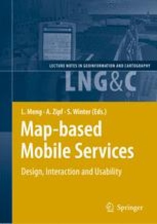
It addresses methods and techniques for topics that range from design and rendering, context modelling, personalisation, multimodal interaction to usability test. Instead of striving for a seamless coverage of all essential theoretical and technical issues with an equal depth and extent, we attempt to pinpoint a number of research highlights and representative development activities at universities, research institutions and so- ware industry. The operational prototypes and platforms reported in the book are on the one hand outcome and feasibility proof of various approaches. On the other hand, they serve as a new starting point for the refinement of user interfaces and iterative usability tests.
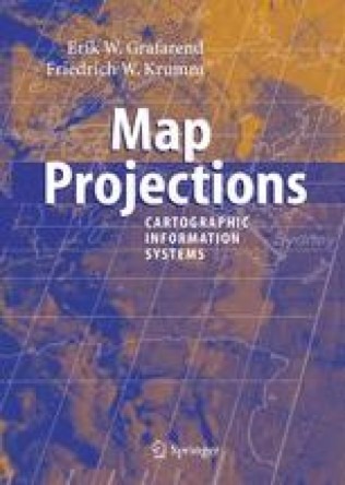
In the context of Geographical Information Systems (GIS) the book offers a timely review of map projections (sphere, ellipsoid, rotational surfaces) and geodetic datum transformations. For the needs of photogrammetry, computer vision, and remote sensing space projective mappings are reviewed.

Ddevoted to modern knowledge and milestones in both experimental and theoretical techniques related to light scattering and radiative transport problems. It will consist of 3 parts comprising 11 contributions written by world leading experts in their respective fields. The general focus of the book will be on remote sensing of geophysical media. The first part will be devoted exclusively to studies of single light scattering by particles of different shapes and chemical compositions. The first chapter will review in situ measurements of cloud optical characteristics like cloud extinction and phase function, with the emphasis on ice clouds. Chapter 2 will cover opitcally soft particles common in marine environments and bio-suspensions while Chapter 3 will describe numerical techniques applicable not only to isotropic but also to chiral and anisotropic mdia. The final chapter in this part will deal with spatial symmetries in light scattering problems.
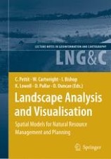
This book presents a collection and synthesis of many of these perspectives — perhaps it could only be produced in a land urb- ised in the tiniest of pockets, and yet so daunting with respect to the way non-populated landscapes dwarf its cities. Many travel to Australia to its cities and never see the landscapes — but it is these that give the country its power and imagery. It is the landscapes that so impress on us the need to consider how our intervention, through activities ranging from resource exploitation and settled agriculture to climate change, poses one of the greatest crises facing the modern world. In this sense, Australia and its landscape provide a mirror through which we can glimpse the extent to which our intervention in the world threatens its very existence.
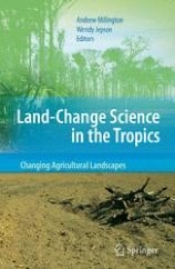
Land use and land-cover change research over the past decade has focused mainly on contemporary primary land-cover conversions in the tropics and sub-tropics, with considerable resources dedicated to the explanation and prediction of tropical deforestation and often ignoring the dynamism in the world’s agro-pastoral landscapes. This collection integrates cutting-edge research in the social, biogeophysical, and geographical information sciences to understand the human and environmental dynamics that change the type, magnitude and location of land uses and land covers in the changing countryside.This book describes the monitoring of land-cover changes, explains the processes through which land is altered, and describes the development of spatially-explicit models to predict land change. This book illustrates how practitioners have integrated knowledge from the three scientific realms - social, biophysical, and GIScience - that underpin land-change science.

It systematically summarizes the past achievements and identifies the frontier issues as the research agenda for the near future. It covers all aspects of land remote sensing, from sensor systems, physical modeling, inversion algorithms, to various applications. The papers on remote sensing system evaluate the capabilities of different sensor systems for estimating key land surface variables and how they can best be improved and integrated effectively in the future.
Terrain analysis has been an active study field for years and attracted research studies from geographers, surveyors, engineers and computer scientists. With the rapid growth of Geographical Information System (GIS) technology, particularly the establishment of high resolution Digital Elevation Models (DEM) at national level, the challenge is now focused on delivering justifiable socio-economical and environmental benefits. The contributions in this book represent the state of the art of terrain analysis methods and techniques in areas of digital representation, morphological and hydrological models, uncertainty and applications of terrain analysis.
The individual papers represent a valuable collection of information on the current state-of-the-art research in the field of 3D geoinformation. It covers a range of these challenges, collected under the themes of Applications, Acquisition, Modelling, Analysis and Visualisation. The main strength of the collection concerns the data modelling and DBMS implementation issues with 3D GIS.
Acollection of world class paper articles addressing the following topics: Image and Pattern Recognition: Compression, Image processing, Signal Processing Architectures, Signal Processing for Communication, Signal Processing Implementation, Speech Compression, and Video Coding Architectures. Languages and Systems: Algorithms, Databases, Embedded Systems and Applications, File Systems and I/O, Geographical Information Systems, Kernel and OS Structures, Knowledge Based Systems, Modeling and Simulation, Object Based Software Engineering, Programming Languages, and Programming Models and tools. Parallel Processing: Distributed Scheduling, Multiprocessing, Real-time Systems, Simulation Modeling and Development, and Web Applications. New trends in computing: Computers for People of Special Needs, Fuzzy Inference, Human Computer Interaction, Incremental Learning, Internet-based Computing Models, Machine Intelligence, Natural Language Processing, Neural Networks, and Online Decision Support System.

سوريا - اتستراد درعا - غباغب
+963-15 2050 - 15 860 380 /1/2/3 - 11 662 3900