



Page 10
Page 10
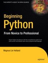
Beginning Python : From novice to professional
Ten different projects illustrate the concepts introduced in the book. You will learn how to create a P2P file-sharing application and a web-based bulletin board, and how to remotely edit web-based documents and create games. Author Magnus Lie Hetland is an authority on Python and previously authored Practical Python. He also authored the popular online guide, Instant Python Hacking, on which both books are base

Artificial intelligence techniques in hydrology and water resources management
The sustainable management of water cycles is crucial in the context of climate change and global warming. It involves managing global, regional, and local water cycles, as well as urban, agricultural, and industrial water cycles, to conserve water resources and their relationships with energy, food, microclimates, biodiversity, ecosystem functioning, and anthropogenic activities. Hydrological modeling is indispensable for achieving this goal, as it is essential for water resources management and the mitigation of natural disasters. In recent decades, the application of artificial intelligence (AI) techniques in hydrology and water resources management has led to notable advances. In the face of hydro-geo-meteorological uncertainty, AI approaches have proven to be powerful tools for accurately modeling complex, nonlinear hydrological processes and effectively utilizing various digital and imaging data sources, such as ground gauges, remote sensing tools, and in situ Internet of Things (IoT) devices.
Artificial intelligence techniques for satellite image analysis
The main objective of this book is to provide a common platform for diverse concepts in satellite image processing. In particular it presents the state-of-the-art in Artificial Intelligence (AI) methodologies and shares findings that can be translated into real-time applications to benefit humankind. Interdisciplinary in its scope, the book will be of interest to both newcomers and experienced scientists working in the fields of satellite image processing, geo-engineering, remote sensing and Artificial Intelligence. It can be also used as a supplementary textbook for graduate students in various engineering branches related to image processing.
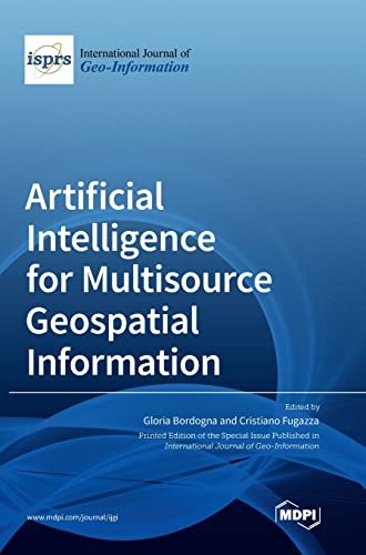
Artificial intelligence for multisource geospatial information
Collects 10 original research contributions published in the Special Issue entitled “Artificial Intelligence for Multisource Geospatial Information” of the ISPRS International Journal of Geo-Information. The focus is on different methods of Geospatial Artificial Intelligence (GeoAI) based on deep learning using different network architectures, clustering, soft computing, and semantic approaches. They are proposed to deal with a variety of Geospatial Big Data (GBD), such as georeferenced texts and photos in social networks, remote sensing images, cartographic maps, multidimensional geo databases, metadata in spatial data infrastructures, and for different tasks, such as for multisource georeferenced text integration and geodata flexible querying, for social sensing by applying sentiment analysis, clustering and geo analysis, for segmentation of roads, clouds and snow, and for detection of small targets and people on the streets.
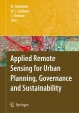
Applied Remote Sensing for Urban Planning, Governance and Sustainability
Despite the promising and exciting possibilities presented by new and fast-developing remote sensing technologies applied to urban areas, there is still a gap perceived between the generally academic and research-focused spectrum of results offered by the “urban remote sensing” community and the application of these data and products by the local governmental bodies of urban cities and regions. While there is no end of interesting science questions that we can ask about cities, sometimes these questions don't match well with what the operational problems and concerns of a given city are. The authors present data from six urban regions from all over the world. They explain what the important questions are, and how one can use data and scientific skills to help answer them.
An Introduction to Network Programming with Java
This book provides an overview of Java … . Each chapter is supplemented with practical programming exercises.The combination of code templates with good supporting discussions allows a competent Java programmer to rapidly expand his or her skill base to include network programming.

Aerosol Optics : Light Absorption and Scattering by Particles in the Atmosphere
Provides a comprehensive review of available techniques for the remote sensing of aerosols. Although mostly satellite remote sensing is considered, ground-based techniques are also discussed.describes techniques for the determination of the column concentration of aerosol particles and their optical sizing using spaceborne optical instrumentation. The majority of the techniques described in this book use a so-called "library method". This method relies upon the precalculated top-of-atmosphere reflectances (TOAR) for vaious atmospheric aerosol types. The comparison of measured and calculated TOARS allows one to characterize the optically-equivalent aerosol state.

Advances in the Geological Storage of Carbon Dioxide : International Approaches to Reduce Anthropogenic Greenhouse Gas Emissions
As is now generally accepted mankind’s burning of fossil fuels has resulted in the mass transfer of greenhouse gases to the atmosphere, a modification of the delicately-balanced global carbon cycle, and a measurable change in world-wide temperatures and climate. Although not the most powerful greenhouse gas, carbon dioxide (CO) drives climate 2 change due to the enormous volumes of this gas pumped into the atmosphere every day. Produced in almost equal parts by the transportation, industrial and energy-generating sectors, atmospheric CO concentrations have 2 increased by about 50% over the last 300 years, and according to some sources are predicted to increase by up to 200% over pre-industrial levels during the next 100 years. If we are to reverse this trend, in order to prevent significant environmental change in the future, action must be taken immediately.
Advances in Telerobotics
The main purpose of this book is to provide readers with recent advances in the field of Telerobotics. It describes methods, experimental results, applications, and developments, highly relevant for scientists, researchers, and students in Teleoperation. This book is structured in three parts: I. Human System Interfaces, II. Control, and III. Applications. Chapters in part I concentrate on human interface technology which allows a human operator to close the control loop of a remote robot. Topics related to control algorithms - in particular for the case with time delay in the communication network - are the focus in part II, concentrating on bilateral control methods. Part III presents a variety of advanced applications in surgery, space, and other fields relevant to everyday life.
Advances in Sensing with Security Applications
The chapters in this volume were presented at the July 2005NATO Advanced Study Institute on Advances in Sensing with Security App- cations. The ASI was divided into three broadly de?ned but interrelated areas: the - creasing need for fast and accurate sensing, the scienti?c underpinnings of the ongoing revolution in sensing, and speci?c sensing algorithms and techniques. The ASI brought together world leaders from academia, government, andindustry,withextensivemultidisciplinarybackgroundsevidencedby theirresearchandparticipationinnumerousworkshopsandconferences.
Advances in radar systems for target detection and tracking
Radar systems can provide the all-weather and all-time detection and tracking of targets of interest, and they have been extensively applied by the remote sensing community, in applications such as geological exploration, disaster forecasting, traffic monitoring, urban planning, environmental sciences, hydrology, littoral zones, oceans, etc. This reprint contains the several advance research studies on radar systems for target detection and tracking. It includes multipath ghost suppression, maneuvering target tracking, target detection, and other topics.
Advances in Land Remote Sensing : System, Modeling, Inversion and Application
It systematically summarizes the past achievements and identifies the frontier issues as the research agenda for the near future. It covers all aspects of land remote sensing, from sensor systems, physical modeling, inversion algorithms, to various applications. The papers on remote sensing system evaluate the capabilities of different sensor systems for estimating key land surface variables and how they can best be improved and integrated effectively in the future.
Advances in Information Technologies for Electromagnetics
Simple tutorial chapters introduce the reader to cutting edge technologies, such as parallel and distributed computing, object-oriented technologies, grid computing, semantic grids, agent based computing and service-oriented architectures. On such bases, a variety of EM applications is proposed: 1) parallel FDTD codes (both for antenna analysis and for metamaterial applications), 2) grid computing for computational EM (CEM) (with applications to antenna arrays, wireless and remote-sensing systems) 3) mobile agents for parametric CEM modeling 4) complex/hybrid EM software environments (with applications to planar circuits, quasi-optical systems,…) 5) semantic grids for CAE of antennas arrays.

Advances in 3D Geo Information Systems
The individual papers represent a valuable collection of information on the current state-of-the-art research in the field of 3D geoinformation. It covers a range of these challenges, collected under the themes of Applications, Acquisition, Modelling, Analysis and Visualisation. The main strength of the collection concerns the data modelling and DBMS implementation issues with 3D GIS.
Advanced Man-Machine Interaction : Fundamentals and Implementation
Man-machine interaction is the gateway providing access to functions and services, which, due to the ever increasing complexity of smart systems, threatens to become a bottleneck. This book therefore introduces not only advanced interfacing concepts, but also gives insight into the related theoretical background.This refers mainly to the realization of video-based multimodal interaction via gesture, mimics, and speech, but also to interacting with virtual object in virtual environments, cooperating with local or remote robots, and user assistance. this book puts special emphasis on implementation aspects. To this end it is accompanied by software development environments for image processing, classification, and virtual environment implementation. In addition a test data base is included for gestures, head pose, facial expressions, full-body person recognition, and people tracking.
Advanced machine learning and deep learning approaches for remote sensing
Provides research on how technologies such as artificial intelligence-based machine learning and deep learning can be applied to remote sensing. Through this, we can see the process of solving the existing problems of image and image signal processing for remote sensing. These techniques are computationally intensive and require the help of high-performance computing devices. With the development of devices such as GPUs, remote sensing technology, and aerial sensing technology, it is possible to monitor the Earth with high-resolution images and to obtain vast amounts of Earth observation data. The papers published in this reprint describe recent advances in big data processing and artificial intelligence-based technologies for remote sensing technology.

Advanced Environmental Monitoring
This book deals with recent developments and applications of environmental monitoring technologies, with emphasis on optical and biological methods that are rapidly progressing through the integration of emerging technologies from various disciplines.
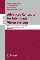
Advanced Concepts for Intelligent Vision Systems ; Vol. 4179 ; 8th International Conference, ACIVS 2006, Antwerp, Belgium, September 18-21, 2006, Proceedings
This book constitutes the refereed proceedings of the 8th International Conference on Advanced Concepts for Intelligent Vision Systems, ACIVS 2006, held in Antwerp, Belgium in September 2006. The 45 revised full papers and 65 revised poster papers presented were carefully reviewed and selected from around 242 submissions. The papers are organized in topical sections on noise reduction and restoration, segmentation, motion estimation and tracking, video processing and coding, camera calibration, image registration and stereo matching, biometrics and security, medical imaging, image retrieval and image understanding, as well as classification and recognition.

Advanced concepts for intelligent vision systems ; Vol. 3708 ; 7th International conference, ACIVS 2005, Antwerp, Belgium, September 20-23, 2005, Proceedings
"Thisvolumecollectsthepapersacceptedforpresentationatthe7thInternational Conferenceon Advanced Conceptsfor IntelligentVision Systems (ACIVS 2005). ThoughACIVS is a conference on all areas in image processing, one of its major domains is image and video compression. A third of the selected papers dealt with compression, motion estimation, moving object detection and other video applications. This year, topics related to clustering, pattern recognition and biometrics constituted another third of the conference. The last third was more related to the fundamentals of image processing, namely noise reduction, ?ltering, restorationandimagesegmentation.We wouldliketothankthe invited speakers Fernando Pereira"

Advanced Concepts for Intelligent Vision Systems ; 9th International Conference, ACIVS 2007, Delft, The Netherlands, August 28-31, 2007, Proceedings
This volume collects the papers accepted for presentation at the Ninth International Conference on “Advanced Concepts for Intelligent Vision Systems”The ACIVS conference was established in 1999 in Baden-Baden (Germany) as part of a large m ulticonference. Since then ACIVS has been developed as an independent scientific event and has maintained the tradition of being a single track event with oral presentations of 25 minutes each, even though the number of participants has been steadily growing every year. The conference currently attracts computer scientists from more than 20 countries, mostly from Europe, Australia and Japan, but also from the USA, Asia and the Middle East.
