Headway in Spatial Data Handling : 13th International Symposium on Spatial Data Handling
For sustainable development, climate change or more simply resource sharing and economic development, this information helps ...
Continue reading
Innovations in 3D Geoinformation Science
This book covers various aspects of spatial data modelling specifically regarding three-dimensional (3D) modelling and structuring. ...
Continue reading
Integration of Information for Environmental Security
Currently the necessary information exists in a multitude of forms and formats geographically and physically scattered over ...
Continue reading
Knowledge Cartography : Software Tools and Mapping Techniques
The authors see mapping software as a set of visual tools for reading and writing in a networked age. In an information ocean, ...
Continue reading
Land-Change Science in the Tropics: Changing Agricultural Landscapes
Land use and land-cover change research over the past decade has focused mainly on contemporary primary land-cover conversions ...
Continue reading
Landscape Analysis and Visualisation : Spatial Models for Natural Resource Management and Planning
This book presents a collection and synthesis of many of these perspectives — perhaps it could only be produced in a land ...
Continue reading
Light Scattering Reviews 3 : Light Scattering and Reflection
This book is devoted to modern knowledge and milestones in both experimental and theoretical techniques related to light ...
Continue reading
MATLAB® Recipes for Earth Sciences
MATLAB is used in a wide range of applications in geosciences, such as image processing in remote sensing, generation and ...
Continue reading
Map Projections
In the context of Geographical Information Systems (GIS) the book offers a timely review of map projections (sphere, ellipsoid, ...
Continue reading
Map-based Mobile Services : Design, Interaction and Usability
It addresses methods and techniques for topics that range from design and rendering, context modelling, personalisation, ...
Continue reading
Maritime Spatial Planning
This book is the first comprehensive overview of maritime spatial planning. Situated at the intersection between theory and ...
Continue reading
Martin Waldseemüller’s 'Carta marina' of 1516 Study and Transcription of the Long Legends
This book presents the first detailed study of one of the most important masterpieces of Renaissance cartography, Martin ...
Continue reading
Mobility, Data Mining and Privacy : Geographic Knowledge Discovery
This book assesses this research frontier from a computer science perspective, investigating the various scientific and technological ...
Continue reading
Multimedia Database Retrieval
Multimedia Database Retrieval: A Human-Centered Approach presents the latest development in user-centered methods and the ...
Continue reading
Multiscale Modeling
The book is aimed at statisticians, applied mathematicians, and engineers working on problems dealing with multiscale processes ...
Continue reading
Object-Based Image Analysis : Spatial Concepts for Knowledge-Driven Remote Sensing Applications
This book discusses means, technologies and approaches related to the processing and analysis of multi-sensor, multi-resolution ...
Continue reading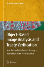
Object-Based Image Analysis and Treaty Verification : New Approaches in Remote Sensing – Applied to Nuclear Facilities in Iran
This book describes recent progress in object-based image interpretation, and also presents many new results in its application ...
Continue reading
Observing our Changing Earth
Contains a selection of 99 papers from the International Association of Geodesy (IAG) quadrennial General Assembly, held ...
Continue reading
Open Source Approaches in Spatial Data Handling
The role open-source geospatial software plays in data handling within the spatial information technology industry is the ...
Continue reading
Open Source GIS : A GRASS GIS Approach
With this third edition of Open Source GIS: A GRASS GIS Approach, we enter the new era of GRASS6, the first release that ...
Continue reading