GeoSpatial Semantics
Constitutes the refereed proceedings of the First International Conference on GeoSpatial Semantics, GeoS 2005, held in 2005. ...
Weiterlesen
Geodetic Deformation Monitoring: From Geophysical to Engineering Roles
Geodesy is the science dealing with the determination of the position of points in space, the shape and gravity field of ...
Weiterlesen
Geodynamics of the Lithosphere
This second edition of the important introductory text for earth scientists has been thoroughly revised and extended. It ...
Weiterlesen
Geographic Hypermedia
This book introduces a new paradigm, Geographic Hypermedia, which emerges from the convergence of Geographic Information ...
Weiterlesen
Geographic Information Science
The GIScience conference series (www. giscience. org) was created as a forum for all researchers who are interested in advancing ...
Weiterlesen
Geographic Uncertainty in Environmental Security
Proceedings of the NATO Advanced Research Workshop on Fuzziness and Uncertainty in GIS for Environmental Security and Protection.was ...
Weiterlesen
Geomatics Solutions for Disaster Management
Natural and anthropogenic disasters have caused a large number of victims and significant social and economic losses in the ...
Weiterlesen
Geospatial Technologies and Homeland Security : Research Frontiers and Future Challenges
This book presents an overview of the latest development of geospatial technologies (including, but not limited to, GIS, ...
Weiterlesen
Geospatial Vision : New Dimensions in Cartography
This book reflects the diverse nature of interests of contributors in the field. The GeoCart conferences are held every two ...
Weiterlesen
Granite genesis: in-situ melting and crustal evolution
In this book we suggest an alternative model for the origin of granite in terms of in-situ meltingintracrustal convection ...
Weiterlesen
Headway in Spatial Data Handling : 13th International Symposium on Spatial Data Handling
For sustainable development, climate change or more simply resource sharing and economic development, this information helps ...
Weiterlesen
Historical Seismology : Interdisciplinary Studies of Past and Recent Earthquakes
Modern seismology has faced new challenges in the study of earthquakes and their physical characteristics. This volume is ...
Weiterlesen
Information Fusion and Geographic Information Systems
This volume contains the papers presented at the International Workshop “Inf- mation Fusion and Geographical Information ...
Weiterlesen
Innovations in 3D Geoinformation Science
This book covers various aspects of spatial data modelling specifically regarding three-dimensional (3D) modelling and structuring. ...
Weiterlesen
International Perspectives on Maps and the Internet
Little notice was taken of the first web map but the development of Internet cartography since has been nothing but remarkable. ...
Weiterlesen
Introduction to Planetary Science
This textbook is intended to be used in a lecture course for college students majoring in the Earth Sciences. Planetary ...
Weiterlesen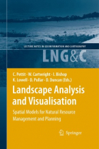
Landscape Analysis and Visualisation : Spatial Models for Natural Resource Management and Planning
This book presents a collection and synthesis of many of these perspectives — perhaps it could only be produced in a land ...
Weiterlesen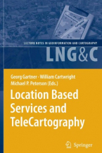
Location Based TeleCartography and Services
This book provides for the first time a general overview of research activities related to location and map-based services. ...
Weiterlesen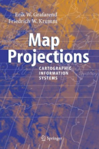
Map Projections
In the context of Geographical Information Systems (GIS) the book offers a timely review of map projections (sphere, ellipsoid, ...
Weiterlesen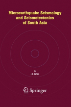
Microearthquake Seismology and Seismotectonics of South Asia
This volume comprehensively deals with plate tectonics and seismic waves in general and earthquake monitoring by permanent ...
Weiterlesen